Walking the Past: Twin Tunnels and the Old Penstock Route (DH-2/3)
| Trip Name | Walking the Past: Twin Tunnels and the Old Penstock Route (DH-2/3) |
|---|---|
| Trip Start Date | Friday, January 23, 2026 |
| Type of Trip | Day Hike |
| Rating | DH-2/3 |
| Leader Name | Victoria Purkey |
| Leader Email | vicop_1776@hotmail.com |
| Roundtrip Drive Mileage | 296 |
| Carpooling Cost | $35 |
| Additional Fees | Parking Pass $10-$12 OR Oregon State Parks annual pass |
| Trailhead Name | Mark O. Hatfield West |
| Longitude/Latitude | 45.7035356, -121.4873508 |
| Trip Description | Twin Tunnels Route
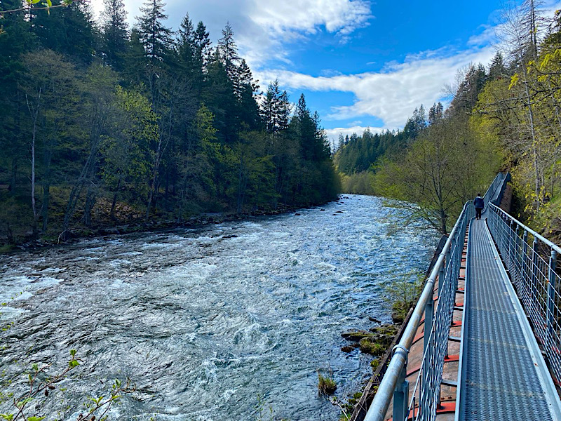
The round-trip route from the Mark O. Hatfield West Trailhead to the Mosier Twin Tunnels is approximately 7 miles, mostly flat with a firm, paved surface that makes it suitable for a wide range of fitness levels and family-friendly for those comfortable with the distance. This stretch of the Historic Columbia River Highway State Trail offers rolling forested hills, excellent viewpoints of the Columbia River, and a memorable walk through the restored Twin Tunnels—once sealed when I-84 opened and now reopened to foot traffic. It is a scenic, easy-to-moderate winter hike with historic features and sweeping Gorge views. Bring microspikes appropriate for paved surfaces in case of icy conditions. Penstock Flume Extension The Penstock Flume is a short, easy-to-moderate add-on hike. The route follows the old penstock catwalk near the former powerhouse, offering unique views of the river, concrete supports scattered by past floods, and an up-close look at early hydroelectric structures. Though mostly flat and on firm surfaces, the flume includes narrow sections, drop-offs, and uneven footing, making it exciting while still accessible for many hikers and families with good supervision. Bring microspikes if conditions are icy, as the surfaces can be slick. What to Bring Bring $35 for your driver. The parking may also be covered by an Oregon State Parks annual pass. |
| Approximate Mileage | 7 miles and 6 (optional) |
| Elevation Gain | 800 feet elevation gain |
| Departure Time | 7:00 AM |
| Sign up by | January 20, 2026 |
Each participant is responsible for their own safety and being prepared. PLANNING and preparation start with the 10 ESSENTIALS and staying up-to-date on road and trail conditions, permit requirements, party size limits, snowpack, wildfires, and weather. Visit the ACTIVITY CLASSIFICATION PAGE for detailed information on difficulty rating for I-MAC trip so you can sign up for activities that best match your fitness and comfort levels.
Visit TRIP COSTS & PASSES for detailed information about trip costs.
To help protect and care for these special places that we enjoy exploring, I-MAC members always practice LEAVE NO TRACE and follow the 7 PRINCIPLES OF LEAVE NO TRACE. Ask your trip leader if you have questions about Leave No Trace or suggestions for helping to reduce our footprint.