Mt Adams Mazama Glacier Route (BP-4, G-2)
| Trip Name | Mt Adams Mazama Glacier Route (BP-4, G-2) |
|---|---|
| Trip Start Date | June 19, 2026 |
| Type of Trip | Mountain Climb |
| Rating | BP-4, G-2 |
| Leader Name | Forrest Heller |
| Leader Email | fdheller@yahoo.com |
| Roundtrip Drive Mileage | 240 miles |
| Carpooling Cost | $29.00 |
| Additional Fees | USFS Forest Pass for Drivers |
| Trailhead Name | Cold Springs |
| Latitude/Longitude | 46.135728752514865, -121.49755636412652 |
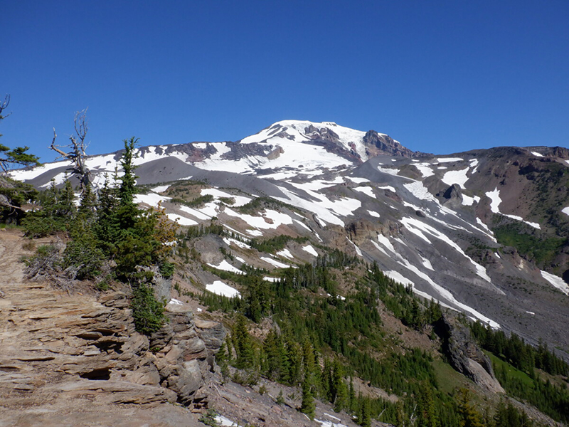
| Trip Description | Mt Adams is the 2nd highest mountain in Washington and is a sight commonly seen while driving around the state. The majority of the trips to the summit are done by the main route on the south side. This trip is to up by the far less common Mazama Glacier route just to the east of the main south side route. We will start at the common Cold Springs trailhead and head to the round the mountain trail and head east for a few miles. The next day we will travel up the Mazama Glacier up to lunch counter coming in from the east. The next day we will summit by the standard route and descend the mountain by the standard route. Some prior crampons, ice axes, harness and rope experience are required so please inquiry with trip leader (fdheller@yahoo.com) prior to signing up. Provided picture is an internet provided image. |
| Approximate Mileage | 15 miles |
| Elevation Gain | 7,000 ft |
| Departure Time | 7:00 AM |
| Sign up by | June 12, 2026 |